Thursday, September 20, 2012

Chicago, Illinois - 09/20/12

We departed Waterloo, Iowa at 8:00 a.m. Today our route will continue on US-20 through Iowa and into Illinois.

As we passed through Dubuque, Iowa, fond memories flooded back on the trip we took in our 1989 Pace Arrow motorhome to the gambling boat in Dubuque in the summer of 1992. On that trip we had my mother, two of my aunts and two of my female cousins on board. My mother had made arrangements for one evening to be spent at the Timberland Lodge, on the Illinois side, while Sharon and I spent the evening in our motorhome on the Timberland property. We all had such a wonderful time on that trip.

We stopped in Lena, Illinois to check out the Lake Le-Aqua-Na State Park for future reference and to dump our gray and black water tanks. It turned out to be a very nice scenic park, nice campsites with electric hookups and close to Galena, Illinois.

We arrived home at 2:15 p.m., completing a 5,022 mile trip through Wisconsin, Minnesota, North Dakota, Montana, Wyoming, South Dakota and Iowa.

On to our next adventure!

Click Here For More Pictures

Wednesday, September 19, 2012

Mitchell Corn Palace - 09/19/12

We got off to an early start this morning and arrived at the Corn Palace in Mitchell, South Dakota at 9:00 a.m.

The World’s only Corn Palace stands as a majestic, uniquely American, folk art icon on the rolling prairies of South Dakota. Mitchell’s first Corn Palace was built in 1892, when the city of Mitchell was just 12 years old. Early settlers displayed their agricultural bounty on the building’s exterior to prove the fertility of the soil and to attract immigrant farmers to settle here. To this day, over 100 years later, the tradition of the Corn Palace continues in Mitchell.

"Corn-By-Number" Decorating
Each year a new decorating theme is chosen and the outside of the Corn Palace is stripped and redecorated with new corn and grains. Over the summer, 3,000 bushels of rye, oat heads and sour dock are tied in bundles and attached. When the crop is ready, 275 thousand ears of corn are sawed in half lengthwise and nailed to the building following patterns created by local artists. This folk art wonder attracts thousands of visitors each year and is the center of community activity within Mitchell.

Today much of the work is done by hand and it is a delicate and detailed process. In early June the border trim of rye and sourdock is removed from the building. The new sourdock and rye is cut, tied into bundles and stapled to the building, typically by the end of July. After the old murals are removed in mid-August, sketches created by local artists are transferred to roofing paper and nailed to the mural panels on the building. These sketches also serve as blueprints, as each color of corn and the area it covers is indicated on the drawing. Just think of it as a large-scale corn-by-number. Thirteen shades of colored corn currently are planted in separate fields to maintain color purity, and the very best ears are handpicked for use on the Corn Palace. Each ear of corn is then sawed in half, shaped and trimmed to fit in the designated spaces, then nailed into place.

This year’s theme was the 2012 summer Olympics. The creation of Olympic athletes with colored ears of corn was amazing. This was my third visit and Sharon’s fourth visit to this wonderful place. Sharon was here in 1962 with her family and she and I visited here in 1992, 1996 and now 2012.

On to our next stop… Waterloo, Iowa!

We departed Mitchell, South Dakota at 11:10 a.m. Our planned route will be to take I-90 eastbound to I-29. We will then take I-29 southbound to Sioux City, Iowa where we will pick up route US-20. In keeping with our desire to minimize Interstate travel, we will travel US-20 eastbound across the entire state of Iowa.

There is quite a contrast between South Dakota and Iowa. The western part of South Dakota is a mountainous region. In the central part of South Dakota there is a vastness of rugged hilly terrain. In the eastern part there are vast areas of agriculture. Iowa, on the other hand, was totally agriculture driven throughout the state on US-20, with vast rolling hills of well maintained farmland.

We arrived at a Walmart in Waterloo, Iowa at 6:40 p.m. This would be our home for the night.

Click Here For More Pictures

Tuesday, September 18, 2012

Mitchell, South Dakota - 09/18/12

We departed the Badlands NP at 11:20 a.m. Our destination today is Mitchell, South Dakota to view the Corn Palace. Mitchell is about 200 miles east of the Badlands on I-90.

We decided our route to Mitchell would not be on the I-90 Interstate highway. We wanted to enjoy the local scenery and culture on the back roads. Therefore, our route from the Badlands to Mitchell would be eastbound on SD-44 to SD-37, then northbound into Mitchell.

Our last view of the Badlands, as we were driving east on SD-44, was the silhouette of four wild horses off in the distance to the north, high up on a butte. A fitting tribute to our exit from the Badlands. The remainder of our trip to Mitchell was filled with scenery of the vast rugged ranchlands that occupy this part of South Dakota. The land here is not suitable for farming crops, so it is mainly used for raising cattle and horses. It really highlights how difficult life must be in this desolate part of our country.

We arrived at a Walmart in Mitchell at 4:45 p.m. This would be our home for the night.

Click Here For More Pictures

Monday, September 17, 2012

Badlands National Park - 09/17/12

Today is our last day in the Badlands. The windy weather has cleared out producing a beautiful sunny day with a light breeze with temperatures in the mid-60’s.

Sharon was feeling a bit funky when she awoke this morning so we decided we would just chill out around the campground. She was feeling a little better in the afternoon, so we visited a few of our favorite spots in the Badlands one last time.

One last marvelous sunset to view in the Badlands, with my sweetheart beside me. Life is good!

Click Here For More Pictures

Sunday, September 16, 2012

Badlands National Park - 09/16/12

We woke up to a very windy, partially overcast day with temperatures in the low 70’s. It was a very strong wind that would blow at a steady 35 mph all day long. Undeterred, we headed out for a day of windy adventure.

Our first stop was to the Saddle Pass Trail. We had hiked this trail in 1996, for about 4 hours at that time. It is a strenuous climb up a high rock formation. At the top is a large flat grassland plain surrounded by other higher rock formations. We had no intentions of repeating this hike this time. Age has a funny way of limiting some of your activities. In 1996 we had to climb over large boulders that lined a trail up to the top. Now the park service has carved a gravel trail to the top making it a much more manageable hike up the mountain. The boulder-lined trail we took in 1996 is still there for the more adventuresome to pursue. Looking at the Saddle Pass Trail today, we were awestruck we actually succeeded in hiking this trail in 1996. At that time the temperature was in the high 90’s and we consumed all of the water we carried in our two large canteens by the time we made it back down to the parking lot. It was a beautiful site at the grass-lined top. It was on this hike that we spotted our first rattlesnake slithering across the trail in front of us. Fond memories of a great hiking experience in the past.

We continued our tour of other scenic wonders within this magnificent park. Every turn on the winding, hilly paved road through the Badlands brings a new breathtaking barren mountain vista to enjoy. We stopped for a picnic lunch at the Conata Picnic area. Barren mountains surround this area on three sides that provided some relief from the harsh wind that was blowing fiercely out of the northeast. This picnic area is located on Conata Road (SD-509) a short distance from the western leg of the Badland Loops Road. Entertainment for our picnic was provided by tiny mountain chipmunks that scurried about the area looking for handouts. They were only about 6 inches long and the speed at which they ran up and down those mountains was absolutely amazing. It was a very entertaining and fulfilling picnic indeed.

We visited the missile Launch Facility Delta-09 just south of I-90 at Exit 116. There is a glass enclosure over the silo where the deactivated rocket is on display. Visitors call a number on their cell phone to receive an audio self-guided tour of this facility. It was a sobering experience standing right on top of a rocket that was once armed with a 1.2 megaton nuclear bomb. It brought back memories of how close the United States came to launching these missiles during the Cuban missile crisis in 1962. Thank goodness the Soviet Union blinked!

We wrapped up the day retreating to the comfort of our Casita, our vacation home on wheels. The velocity of the wind was brutal and the temperature had dropped into the low 60’s. Our nightly ritual of cheese and crackers with a fine glass of wine would be indoors tonight!

Tomorrow another adventure begins.

Click Here For More Pictures

Saturday, September 15, 2012

Badlands National Park - 09/15/12

We got off to a late start today at 12:30 p.m. Our stargazing from last night made for a late bedtime resulting in a late wakeup at 9:20 a.m. We decided we would do a routine nonstop tour of the Badlands, scouting areas we would revisit later. We would also do our obligatory visit to Wall Drugs.

Our first stop was at the Ben Reifel Visitor Center. This a wonderful place to visit to get a perspective on the history of how the Badlands were formed and the wildlife that existed here thousands of years ago. This center is much improved from our last visit in 1996. It now features a 97-seat theater with a short film on the history of the Badlands. The center also features paleontologists working on fossils in the center’s laboratory. Our visit to the laboratory really highlighted how tedious this profession is and the level of concentration required.

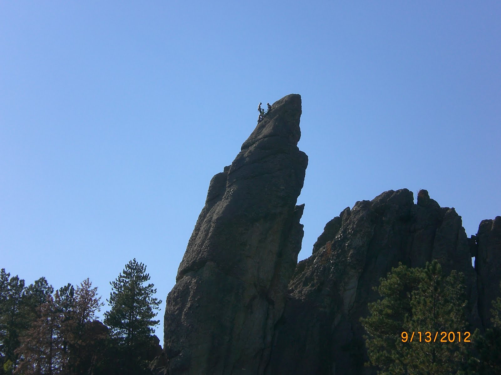
Deep canyons, towering spires, and flat-topped tables are all found within the 244,000 acres of the Badlands. They are largely the result of two basic geologic processes: deposition and erosion.

Millions of years ago the Badlands were part of a shallow sea. About 500,000 years ago the Badlands evolved into a flat flood plain. The receding waters began to cut down through the rock layers, carving fantastic shapes. Many of the layers are gently warped and faulted due to the mountain building activities that formed the Black Hills, 70 miles to the west. Erosion is ongoing. Every time it rains, more sediment is washed from the buttes. While the Badlands are permanent in human terms, they are short lived on a geologic time scale. Erosion rates suggest that they will erode away completely in another 500,000 years

At one time the Badlands had a subtropical climate similar to that of Florida. Fossil remains show that alligators were prominent here during the time this area was a floodplain. This area was also home to a variety of prehistoric mammals and sea creatures that did not survive the climate change that evolved when the Badlands were being formed.

There is a Badlands Loop Road that visitors take to view the magnificent rock formations throughout the park. From the Ben Reifel Visitor Center the western leg of the Loop Road runs 29 miles north connecting with I-90 at Exit 110. The eastern leg runs 8 miles north connecting with I-90 at Exit 131.

The western leg of the Loop Road exits at Wall, South Dakota, famous for Wall Drugs. Billboard signs posted on I-90 as far away as 400 miles, east and west, from Wall advertise Wall Drugs. It has been a required tourist stop along I-90 ever since it opened in 1931. The main street in downtown Wall is one very long block in length, running south to north, with Wall Drugs occupying the entire block on the east side of the street. Souvenir stores and bars occupy the west side of the street. They have a wide main street with angled parking on the east and west sides of the street and two rows of angled parking in the center of the street. They have several other large parking areas dispersed throughout the town to handle the influx of RV’ers during the summer and fall seasons.

At I-90, Exit 131, on the eastern leg of the Loop Road there is a Minuteman Missile Visitor Center. Visitors can view a short film on the development and deployment of the Minuteman Missiles as well as a brief history of the Cold War with the Soviet Union that began in the 1960’s. Both countries developed an arsenal of nuclear missiles capable of reaching and destroying the other side in just 30 minutes.

Due to innovative solid-fuel rocket technology, by the late 1960’s the United States had deployed 1,000 Minuteman missiles in the Midwest and the upper Great Plains, including 150 in South Dakota. All of these missiles were housed in underground silos built to withstand a nuclear blast and could be launched by crews stationed at launch control centers miles away. In 1991 the U.S. signed the Strategic Arms Reduction Treaty with the Soviet Union to reduce the number of nuclear missiles. All of South Dakota’s missiles were deactivated and 149 silos imploded. Delta –09 remains intact to help tell the story of the Minuteman’s role in deterring a conventional war and preserving peace.

Visitors can view the Launch Facility Delta-09 site. It is open daily from 8:00 a.m. to 4:30 p.m. A self-guided cell phone tour is available to guide your visit. The location is on a gravel road just south of I-90 at Exit 116. During the period of time this missile silo was active, traffic on I-90 was not aware that within a short distance from them was a missile loaded with a 1.2 megaton warhead. Designed to travel over the North Pole at a top speed of 15,000 mph, it could arrive at its target over 6,000 miles away in 30 minutes. The warhead carried the explosive equivalent of over one million tons of dynamite.

Visitors can also receive a ranger-guided tour of Launch Control Facility Delta-01 and have the opportunity to go into the underground Launch Control Center to learn how Minuteman nuclear missiles could have been launched during the Cold War. The Launch Control Facility is located north of I-90 at Exit 127, just 4 miles west of the Missile Visitor Center and 11 miles east from the Launch Facility Delta-09. For every ten missiles, there was a Launch Control Facility where Air Force officers constantly monitored and remained ready to launch the missiles. In addition an Air Force plane known as the "Looking Glass" could remotely launch the missiles from the sky. During the Cold War this airplane remained airborne 24/7, landing only for crew changes and routine maintenance.

Having completed a full day of travel (61 miles) through the Badlands and to Wall Drugs we retired to our campsite for our evening ritual of cheese and crackers with a nice glass of wine, to view the magnificent sight of the sun setting in the Badlands.

A wonderful day spent exploring the wonders of the Badlands.

Click Here For More Pictures

Friday, September 14, 2012

Badlands National Park - 09/14/12

We departed Custer State Park at 11:30 a.m. Our planned route is to take US-16 east to SD-36 east to SD-79 north to SD-44 east to SD-240 north to the Badlands National Park. A short drive of 101 miles.

We arrived at the Cedar Pass Campground at 1:45 p.m. and were fortunate to find campsite # 22 with an electric hookup. Since our last visit here in 1996, they have added electric hookups to 23 of the 55 campsites. They are also putting the finishing touches on a shower building, which is a nice added feature to this campground.

The weather here is dry and in the 90’s during the day and in the 50’s at night, so it is quite pleasant here this time of the year.

At 10:00 p.m. we went outside for some serious stargazing with our telescope. There is just no comparison to the sky at night like there is in the Badlands. It is devoid of any light except for the stars shining their brightness down to Earth from outer space. It is absolutely amazing; there are literally billions of stars transmitting their light from within our solar system, from millions of light-years away. We were very fortunate to see two shooting stars this evening. The awesome speed that these chunks of meteorites enter the Earth’s atmosphere and burn up is an amazing sight to witness here in the surrounding blackness of night.

The Badlands National Park is one of our favorite places to visit. It is a vast expanse of a moonlike landscape, so desolate at first glance, yet it is teeming with wildlife. There are Coyotes, Bobcats, Bison, Bighorn Sheep, Rattlesnakes, Black-Footed Ferret, Porcupine, Black-Tailed Prairie Dogs, and Foxes.

Before nightfall, we saw two Bighorn Sheep grazing in the distance, while we were having our nightly ritual of cheese and crackers with a nice glass of wine. Life is good!

Tomorrow, we will begin our tour of the Badlands.

Click Here For More Pictures

Thursday, September 13, 2012

Needles Highway - 09/13/12

This is our last day at Custer State Park. We started our tour today with a visit to a cabin in Custer State Park known as Badger Hole. This cabin was home to one of the park’s most colorful historic characters, Charles Badger Clark. He was South Dakota’s first poet laureate.

Clark built his cabin, the Badger Hole, and lived an independent life in the park for the last 30 years of his life. He wrote poetry, read from his extensive library and wrote letters to his many fans. He lived there until his death in 1957 at the age of 74.

His life was fulfilling. As he enjoyed people and people enjoyed him. He gave lectures, told stories and recited his poetry at many social gatherings.

His distinctive dress – riding breeches and boots, military blouse, flowing tie, officer-type jacket and broad-brimmed hat – illustrated the independence and mystery of this larger-than-life man.

The cabin is located in an isolated patch of pine forest. It is a fairly large, well-preserved, single story log cabin structure, about 30 feet square. Unfortunately, we were not able to view the inside of the cabin since it is only open for public tours from Memorial Day through Labor Day.

We continued on our adventure by taking the Needles Highway Scenic Drive that runs north on SD-87 within Custer State Park. It is a 14- mile, very narrow, hilly, winding road with several 10 mph hairpin curves.

There are two tunnels carved through the granite rock on this route that accommodate only one vehicle at a time. The first tunnel provided adequate clearance for our Ford E150 Van and is about three car lengths long. The second tunnel was very narrow and we had to fold the passenger side mirror in. Sharon could just about touch the wall of this tunnel with her arm outstretched. This tunnel was about five car lengths long.

These are not the smooth-sided concrete tunnels we are accustomed to in the Midwest. These are solid rock tunnels throughout their length. The ceiling and walls are very rough protruding surfaces; probably a result from the blasting and drilling required to carve these tunnels out of the granite rock they go through.

As you exit the second tunnel you immediately encounter a giant granite rock formation called the Needle’s Eye. It is located at the highest point on this highway at an elevation in excess of 6,000 feet. It is a knife-shaped spire that has a large hole through it in the shape of the eye of a sewing needle. It is quite a work of art by Mother Nature.

We were fortunate to come upon three rock climbers getting ready to repel down a granite rock formation. There were two women and one man in the group. The skill, courage and physical strength required for this type of activity is simply amazing.

The Needles Scenic Highway section of Custer State Park is so different from the rest of the park. It’s a spectacular drive through pine and spruce forests, meadows surrounded by birch and aspen and rugged granite mountains. The road’s name comes from the needle-like granite formations which seem to pierce the horizon along the highway.

Our final tour of the day took us back to the Wildlife Loop Road at 5:00 p.m., looking for those darn bison! Finally!! At 6:30 p.m. we spotted a large herd walking single file high up on a hill in the distance. As we got closer we could see they were coming from the other side of the hill, walking along a trail along the top of that hill that took them into an open meadow lower down. It was a wonderful sight; for as far as the eye could see were bison appearing over the horizon from the other side of the hill, following the rest of the herd on the trail at the top of the hill.

To top off the evening, we finished our tour of the Wildlife Tour Road viewing a flock of about 40 wild turkeys. It just does not get any better than this folks!

Off to our next adventure… Badlands National Park, South Dakota.

Click Here For More Pictures

Wednesday, September 12, 2012

Crazy Horse Memorial - 09/12/12

Today we decided we would visit the Crazy Horse Memorial to see what progress has been made since our last visit there in 1996. Fortunately, visitors to the memorial can see the sculpture with binoculars from about 2-1/2 miles away on US-16/385. Progress has been very slow on this sculpture over the years. The facial features have been refined, but that is about all that has been accomplished, from what we could see. This memorial is a non-profit, educational and cultural project, privately financed through donations and entrance fees. The entry fee is $10 per adult or $27 a carload. We decided not to enter the memorial on this trip.

We visited the town of Custer and had a late lunch at Cattleman's, a local restaurant. I had BBQ Buffalo Brisket and Sharon had BBQ ¼ Chicken. Sharon got the better dish. The chicken was moist, tender and delicious. The buffalo brisket was disappointing. It had an excellent taste, but it was somewhat dry and tough. We frequent a BBQ in Naperville, IL that has beef brisket to die for. It is so tender and juicy it just falls apart when you stick a fork in it. Such is life while traveling to new places and sampling the local cuisine, its just another part of the adventure.

We returned to Custer State Park in the late afternoon and toured the Wildlife Loop Road to see what wildlife had ventured out at dusk.. We saw numerous deer, Pronghorn Sheep and one bison! Tomorrow we will visit the Visitor Center to find out where the other 1,449 bison are!

Shortly after we returned to our campground, a flock of wild turkeys were right outside our trailer door. I asked Sharon to inquire if any of them were interested in joining us for Thanksgiving! They dispersed to the other side of the campground in short order. What a shame, there were a few nice plump ones in the flock too!

Another day, another deer, Pronghorn Sheep, one bison, many turkeys…

Click Here For More Pictures

Tuesday, September 11, 2012

Mount Rushmore - 09/11/12

Today we set off to tour the Wildlife Loop Road within Custer State Park. This is a beautiful 31 mile trip that transports the visitor through mountain vistas, open plains and heavily forested areas. Individual Bison were observed at a few locations and several Pronghorn Sheep were observed at a distance and one extremely close-up view right next to our van while traveling on the road to the Bison corral.

We had a nice picnic lunch at the top of Mount Coolidge, at an elevation 6,023 feet. This mountaintop overlooks a forested valley below, with open grassland areas dotting the landscape. One gets a sense of complete tranquility, sitting atop a large boulder on a mountaintop, marveling at the wonders of nature for as far as the eye can see.

We decided we would visit Mount Rushmore this evening, September 11, as a fitting tribute to all of those unfortunate people who were lost on this day 11 years ago. We arrived there at 5:00 p.m. to insure we would get good seats in the open-air auditorium. The lights in the auditorum were dimmed at 8:00 p.m. and the program began with a very nice presentation, by a young female Park Ranger, on the history of Mount Rushmore. A film presentation followed, honoring the four presidents whose images are sculpted out of the massive granite mountain that stands before us: George Washington, Thomas Jefferson, Theodore Roosevelt and Abraham Lincoln. The film was narrated by the deep resonant voice of James Earl Jones. The film highlighted the contributions that each of the presidents had made to preserve and safeguard the freedoms and independence we enjoy as a nation today. The film was followed by the singing of the National Anthem at 8:30 p.m. As the music started, the floodlights came on lighting up Mount Rushmore. The National Anthem was a recording sung by Alicia Keys. It was a beautiful rendition and after she had sung a few words, the audience started to sing softly along with the music. It was an overwhelming moment to experience.

In honor of September 11, the floodlights were to remain on all night.

After the singing of the National Anthem, a very special moment occurred. The Park Ranger requested all visitors who served in the U.S. Armed Forces to come down to the stage in the auditorium. There were a large group of us who responded to her request. She requested six members from those of us on the stage to lower the U.S. flag. Six members responded and there was total silence in the auditorium while the flag was lowered from its half-staff position and subsequently folded military style. At this point, the Park Ranger requested we form into rows on the stage. We formed into five rows, perhaps 50 or more men and women per row. The Park Ranger then came up to each of us with a microphone in hand and requested we give our name and branch of service. It was a nice fitting tribute to those of us who have served our Country.

Our trip to Mount Rushmore from the campground was a thrilling hold-onto-your-seat 20-mile ride on US-16A. We decided we would take this route since it was daylight and the shortest route to Mount Rushmore. In all of our travels, we have never been on a road like this with so many steep hills and hairpin 15 mph curves. It was a very scenic route, with three mountain tunnels to pass through. The tunnels were only wide enough for one vehicle at a time, so honking your horn before you entered and while you were in the tunnel was the appropriate self-preservation action to take. It was agreed we would not take this route back to the campground since it would be quite dark at that time and extremely challenging to navigate.

Okay! So, the program has ended at Mount Rushmore, time to go home. Our plan was to take SD-244 to US-16/385, which would take us to Custer, South Dakota and then take US-16A a short distance to our campground. That plan went awry when I exited Mount Rushmore and went in the wrong direction on SD-244. Now I did not go in the wrong direction for just a short distance, but 10 miles in the wrong direction! However, our misdirected route was not without adventure. About 7 miles driving into the wrong direction, I saw flashing police car lights coming around a curve far behind us in my sideview mirror. I immediately pulled over on the shoulder of the road. Good thing I did too! The next thing we see is a motorcycle fly by us going at least 100 mph with two South Dakota Highway Patrol cars, one marked and one unmarked, in pursuit. This section of highway is a three-lane nicely paved highway, with two lanes on our side for a short distance before it reverts to a two-lane highway. However, it is a hilly and curvy highway. We can only hope that no one was injured in that pursuit.

We finally made it back to the campground around 11:00 p.m. What should have been about a 25 mile trip turned into a 57 mile trip. We took a secret ballot vote upon our return. The results were unanimous! Bob and Sharon voted to reward themselves with one large glass of wine. We had two!!

Quite an ending to an interesting day of adventure and inspirational evening at Mount Rushmore.

Click Here For More Pictures

Monday, September 10, 2012

Custer, South Dakota - 09/10/12

We departed Devils Tower, Wyoming at 11:30 a.m. We decided to take WY-24 east out of Wyoming into South Dakota so we can check out the scenery in the northeastern corner of Wyoming.

Our planned route was to be WY-24 to SD-34 to US-85 to I-90 to US-385 to US-16 to Custer, South Dakota. Well, that plan turned into a slight detour. Just before we got onto I-90 I decided I would use our trusty GPS to guide us to Custer, South Dakota, from the intersection of US-85 and I-90. Big mistake! It took us to the right exit off of I-90 and then took us through a very scenic 20-mile drive through a curvy Canyon road in South Dakota. After a considerable amount of time had passed, Sharon mentioned we were entering Wyoming. Sure enough, the coordinates I entered into the GPS for Custer routed us through to US-85 in Wyoming, then south on US-85 to east on US-16 into Custer. So, what was supposed to be a 120 mile trip turned into a 177 mile trip. Such is life!

We finally arrived at our destination, Game Lodge Campground in Custer State Park at 3:30 p.m. We had stayed at this campground in 1996 and had enjoyed it so much we decided to return for another stay.

Game Lodge Campground is a spacious area with 55 campsites, some shaded and some with electrical hookups. We were fortunate to get site 44E that has electric and some shade with an open area. There is a Laundromat on the premises, which is a nice added feature to this campground. Our campsite is located adjacent to a creek that provides a soothing sound from the water flowing through it. During the early evening hours, deer come to the creek to drink from it and graze. Later in the evening the sound of Coyotes yelping in the distance and an occasional Owl hooting fill the air.

There is a herd of approximately 1,450 Bison that are dispersed throughout this state park. Our campground is protected on three sides by a fence and the entrance is fitted with a metal cattleguard embedded in the road to prevent the Bison from entering the campground. The log fence consists of two horizontal logs spaced about three feet apart attached to two five-foot high vertical logs on each end. However, the fourth side of the campground faces a creek. The other side of the creek is a heavily forested hilly area with no visible barrier. We have not seen any bison pies on the ground within the campground, so all is well! On our visit here in 1996 there were several Bison grazing right outside of the campground.

Custer State Park is a very large park, encompassing 71,000 acres of which 50,000 acres are forested. There are nine campgrounds located within the park. Wildlife is abundant here, comprised of Bison, White-Tailed Deer, Mule Deer, Pronghorn Sheep, Mountain Goats, Burros, Coyotes, Elk, Bighorn Sheep, Prairie Dogs, Wild Turkeys and the top of the food chain; the Mountain Lion.

We are settled in for the night and looking forward to a new adventure on tomorrow

Click Here For More Pictures

Sunday, September 9, 2012

Devils Tower - 09/09/12

This is our third visit to Devils Tower in Devils Tower, Wyoming and each subsequent visit seems like our first. The Indians have worshiped this mountain through the generations. Every visit to this Indian holy place has had a profound spiritual effect on our psyche. A visit here gives one a better appreciation of the Indian beliefs and their culture.

About 50 million years ago molten magma was forced into sedimentary rocks above it and cooled underground. As it cooled it contracted and fractured into columns. Over millions of years, erosion of the sedimentary rock exposed Devils Tower. The Tower rises 867 feet from its base and stands 5,112 feet above sea level. The area of its teardrop-shaped top is 1.5 acres. The diameter of its base is 1,000 feet.

Today, as in our past visits, we hiked the 1.3 mile trail around Devils Tower. As in past visits, there were several groups of climbers scaling different sections of the sheer straight sides of this mountain. On today’s visit, the women ruled. There were more women then men climbers. Words cannot describe the experience of watching the climbers climb this mountain. It was a sight to behold; the various positions of their legs straddling between vertical rock columns, bracing their feet against crevices in the rock, while their fingers are groping for a crevice in the rock above to pull themselves into another position higher up the mountain. Somehow, they are forcing their bodies to literally defy gravity. The mental toughness and physical stamina these climbers possess is phenomenal. According to a posting at the Visitors Center, about 1,000 people climb this mountain each year. It is an amazing feat to personally witness!

We had a picnic lunch at the base of the mountain, at an altitude of 4,250 feet, overlooking a beautiful wide-open green valley below us. On such a warm and sunny day, this was another memorable visit to one of our favorite places in Wyoming.

We stopped to visit the Prairie Dog Town located within the park. This is a vast open grassland area filled with hundreds of earth mounds scattering the landscape, with many more hundreds of prairie dogs scurrying about. These are the black-tailed prairie dog species. They are one of the most social wild animals of North American. They are a member of the squirrel family, but have minute ears and short tails with muscular legs, which suit them well for living in tunnels. They are highly social and live in densely

populated areas referred to as towns. The mounds of excavated earth around their burrows serve as watch towers as well as dikes to keep out water from heavy rains. Today they are found primarily in such protected areas as Devils Tower, Wind Cave National Park, Theodore Roosevelt National Park and Badlands National Park. It is always interesting to view the interaction between these cute little creatures.

Arriving back at the KOA campground, It is now time to relax with a nice glass of wine with cheese and crackers and watch the sun setting on Devils Tower. What a beautiful sight. Scattered wispy clouds surround the mountain. The setting sun reflecting off of these clouds creates a different scenic delight as the minutes tick away, until the sun finally descends beyond the horizon and the mountain fades to black.

A perfect ending to the day at Devils Tower.


Click Here For More Pictures

Saturday, September 8, 2012

Devils Tower - 09/08/12

We awoke to temperatures in the high 20’s. The windows on our Ford Van E150 were frosted over. The forest floor had a white blanket of frost covering it everywhere. It was quite cold, but our trustworthy furnace had our trailer nice and toasty in no time at all.

We departed the Sibley Lakes Campground in the Bighorn National Forest at 8:40 a.m. Our destination today is Devils Tower, Wyoming. Our planned route will take us east on US-14 to north on WY-24 to Devils Tower.

US-14 joins I-90 at Ranchester, Wyoming and the two routes then run south to Sheridan, Wyoming. At Sheridan, US-14 splits off from I-90 and continues on east for about 100 miles before it rejoins I-90 at Gillette, Wyoming. The two routes then run together east for about 29 miles before US-14 splits off from I-90 at Moorcroft, Wyoming. US-14 then runs north a few miles before resuming east to intersect with WY-24. We have avoided the Interstate system on our trip out west as much as possible and opted instead to take local routes wherever possible. The local routes take us through some charming towns and give us the opportunity to experience the local culture and scenery that you miss when traveling on the Interstate system.

Now the white knuckle driving part of our travels began. Shortly after we were on the road we encountered the RV and truck drivers nightmare… Granite Pass! This pass has an elevation of 9,033 feet descending through Shell Canyon. Fortunately, we had already read about this stretch of road in our Mountain Directory for Truckers, RV and Motorhome Drivers. Our descent through Sylvan Pass in Yellowstone National Park provided us with a preview of coming attractions at Granite Pass. The descent on US-14 through Shell Canyon is 6-7% for 18 miles. The first 11 miles are up and down with 5-6% grades and 30 and 40 mph curves. The next 2-1/2 miles are downhill with the grade changing from 6% to 2 or 3% and then back to 6%. At this point, there is a truck warning sign – "Steep Grade Next 9 Miles." And indeed there is! Over the next 9 miles the grade is 5-7% with many 25 and 30 mph curves.

One unique feature of driving through Granite Pass were informational signs posting the age of the different areas we were driving through. They ranged from 50 to 350 million years ago when they were originally formed. I was chatting with Sharon about the information on these signs, when I glanced over at her; the poor dear was clutching the sides of her seat, white-knuckle style. I guess I failed to appreciate how close we were to the edge of the road on her side, overlooking the valley, thousands of feet below us!

We had the option of taking US-14 Alt. That route would have taken us over the "OH My God Hill." The descent on this route is posted at 10% for 10 miles with an additional 4 miles of 8% grade. After we had made it safely down the Granite Pass route, we stopped at a turnout at the base of the mountain pass, Sharon got out of the van, dropped to her knees and thanked me profusely for not taking the route over the "OH My God Hill!"

The outstanding experience of driving east on US-14 through Wyoming were the numerous scenic delights that greeted us on each turn and over each mountain pass. Massive mountains dotted the landscape around us and off in the distance far ahead on the highway. The mountains displayed the effects from the various forces of nature that ravage them over time, resulting in rock slides from erosion that litter the base of the mountains. Some of these rock slides contained massive boulders that were about the size of a two-story house.

We arrived at the KOA private campground located at the base of Devils Tower at 1:10 p.m. It was time to pamper Sharon at a campground with electric and water hookups. Sharon is happy, life is good!

We spent the remainder of the day just relaxing at the campground. We will be here two nights and then depart Monday morning for Custer State Park in Custer, South Dakota.

Click Here For More Pictures

Friday, September 7, 2012

Bighorn National Forest - 09/07/12

We departed Yellowstone National Park at 11:20 a.m., on a beautiful sunny and chilly morning with the temperature in the 30’s. Our next destination is Devils Tower National Monument in Devils Tower, Wyoming.

Our planned route will take us out through the east entrance of Yellowstone National Park. We will travel east on US-14 across Wyoming to north on WY-24 to Devils Tower.

The road to the east entrance of Yellowstone National Park took us through Sylvan Pass at an elevation 8,559 feet. The eastbound descent is about a 1,500 foot drop in elevation in 6 miles. It is a steady 6-7% descent for about 4-1/2miles. The last 1-1/2 miles before reaching the park exit are about a 5-6% grade with rolling hills. Driving through this pass gave us an opportunity to sharpen our mountain driving skills while pulling a trailer!

We were pleased we had made the decision to exit through the east entrance of the park. Once outside of the park this route took us through scenic mountain vistas, rolling hills and vast valley’s dotted with numerous lakes and rivers.

Our original plan was to spend the night at a Walmart in Sheridan, Wyoming. However, at around 6:30 p.m. we were traveling through the Bighorn National Forest, some miles west of Dayton, Wyoming, when we happened to come upon the Sibley Lakes Campground that was located within this forest. Since it was getting late and Sheridan was about 70 miles away we decided to spend the night at this campground. There were several other campers already there, so we felt secure camping there and spent a restful night. It got quite cold tonight, but we were quite comfortable in the sleeping bag we use on our bed for cold nights.

Click Here For More Pictures

Thursday, September 6, 2012

Yellowstone National Park - 09/06/12

Today is our last day in Yellowstone National Park. We decided we would hike some of the trails around our campsite at the Madison Campground. It was an overcast windy day, with temperatures in the mid-60’s. We had a nice picnic lunch at our campsite before embarking on our hike.

There is a narrow, shallow, fast-flowing river within a short walk from the campground that we decided we would hike. We were not disappointed. It is located within a lush green valley surrounded by forested mountains on all sides for as far as the eye can see. The river has several rapids running throughout its journey through this valley. The rapids provide visual evidence of the turbulent forces at work underneath the surface of the water. The water is crystal clear, with patches of underwater green plants and a riverbed filled with perfectly polished stones from the force of the water running over them.

This area is a haven for fly fishermen. There were three fishermen with their wader outfits on, waist deep in the river, fly fishing for trout. The deft movement of their arms as they repositioned their fly lines was poetry in motion. It reminded us of scenes from the movie "A River Runs Through It," starring the actor Brad Pitt.

Another great ending to a perfect day of hiking in Yellowstone National Park.

Click Here For More Pictures

Wednesday, September 5, 2012

Yellowstone, Northern Route - 09/05/12

Today we took the Northern Route around Yellowstone National Park. It is quite interesting to see how the terrain changes throughout the park. The northern route took us through mountain areas reaching altitudes of almost 9,000 feet, to lush grasslands at an altitude of about 5,000 feet. This route also goes to Mammoth Hot Springs, a very popular area to visit.

The Northern Route also goes to Mammoth Hot Springs which is a large complex of hot springs on a hill of travertine. It was created over thousands of years as hot water from the spring cooled and deposited calcium carbonate. The brilliant patches and streaks of browns, yellows and greens covering the hill offer a mosaic of brilliant color.

We had a very nice picnic lunch in Mammoth overlooking the colorful hills of travertine and the town of Mammoth. After lunch, we proceeded on our journey through the Northern Route. We crossed the 45th Parallel of Latitude, halfway between the Equator and the North Pole. We also crossed the Continental Divide at a little under 9,000 feet. Overall, this was a very scenic tour filled with wonderful adventure at every turn, mountain pass and hidden valley. Total miles traveled today: 108

Click Here For More Pictures

Tuesday, September 4, 2012

Yellowstone, Southern Route - 09/04/12

There are two circular routes visitors can take around Yellowstone National Park, the Northern Route and the Southern Route. The Southern Route takes you from Norris through Madison, Old Faithful, West Thumb, Little Bay and Canyon Village and back to Norris. The Northern Route takes you from Norris through Mammoth Hot Springs, Tower Roosevelt, Canyon Springs and back to Norris.

Today we decided to take the Southern Route. Our first stop was at the Old Faithful Geyser. This geyser erupts about every 60 to 110 minutes. Eruptions normally last between 1.5 to 5 minutes. The event leading up to the eruption and the eruption itself puts on quite a show for the viewing audience. Bursts of steaming hot water erupts to an average height of 130 feet into the air. Yellowstone National Park sits upon an active volcano and the Old Faithful Geyser vividly demonstrates the tremendous amount of energy entombed within the earth’s crust.

We departed Old Faithful and continued on our journey around the Southern Route. It was quite interesting to see how the terrain changes from the smoldering acidic thermal pools to open plains containing scattered herds of bison to heavily forested areas and canyon areas with magnificent waterfalls.

We finished the day’s activities with a late afternoon picnic lunch at Fishing Bridge. This area is located on the northern edge of Lake Yellowstone. A beautiful pine forest surrounded us on three sides with a view of the lake as our front door. We arrived back at our campsite at the Madison Campground at 6:00 p.m.

Today is laundry day. We depart our campground at 7:00 p.m. for the 14-mile trip to the town of West Yellowstone, Montana. The Laundromat is located next door to a hotel and is full service! It has separate showers for men and women and it has free secured WiFi. The showers cost $0.25 for each 30 seconds, so don’t dilly dally around, get er done quick! The WiFi allowed us to get caught up on all of our business and personal activities that needed to be tended to.

While at the Laundromat, I spotted a cute little Spanish restaurant across the street. At 9:15 p.m. we entered the restaurant, Café Madriz, and inquired if it was too late to get something to eat. No problem… so let the dining experience begin! The restaurant is very small and tastefully decorated in a Spanish motif, probably seats about 20 people. We ordered the house specialty, "Paella for Two". This dish takes 30 minutes to prepare, so we ordered their special spinach salad to tide us over while the Paella was being prepared. The spinach salad was excellent; it contained pine nuts, goat cheese, large pieces of bacon and a very flavorful oil mixture dressing. The Paella was to die for! The texture, aroma and taste were unsurpassed in our dining experience at other Spanish restaurants we have dined at. This turned out to be an excellent find.

We arrived back at our campground at 11:00 p.m., played cards until midnight, then packed it in for the night. A very memorable day spent in Yellowstone National Park. Total miles traveled today: 102

Click Here For More Pictures

Monday, September 3, 2012

Yellowstone National Park - 09/03/12

We departed Bannack State Park in Bannack, Montana at 10:50 a.m. Our destination today is Yellowstone National Park. Our planned route will be east on MT-43 to north on I-15 to east on I-90 to south on US-287 into Yellowstone National Park.

We arrived in West Yellowstone National Park at 3:00 P.M. We located a campsite at the Madison Campground within the Wyoming section of the park. We will be here for four nights and depart on Friday, 09/07/12.

Click Here For More Pictures

Sunday, September 2, 2012

Bannack Ghost Town - 09/02/12

We departed Missoula, Montana at 9:30 a.m. Our destination today is Bannack, Montana to visit the Ghost Town there. Our planned route will be south on US-93 to east on MT-43 to south on MT-278 into Bannack.

We arrived in Bannack at 3:00 p.m. and found a campsite for the night in the Road Agent Campground at Bannack State Park. There are two campgrounds here, the other one is the Vigilante Campground which is the larger of the two and more suitable for larger RV’s. One water spigot is available at the Vigilante Campground. There is no water at the Road Agent Campground. Both campgrounds have pit toilets, but no showers. A nice feature of these campgrounds is both are within walking distance to the Ghost Town.

This Ghost Town is an amazing place to visit. There are about 50 buildings from the 1860’s gold rush era that have been somewhat preserved. One feels a sense of reliving history as you walk down the hard packed dirt road inspecting the old frame buildings lining both sides of the road. There are well-preserved buildings of the hotel, general store, school, still, jail, homes and many other artifacts. A bit of a distance from the town is the gallows and the cemetery.

Click Here For More Pictures

Saturday, September 1, 2012

Missoula, Montana - 09/01/12

We departed Glacier National Park at 11:45 a.m. Our plan is to spend the night at a Walmart in Missoula, Montana. Our planned route will be south on US-89 to west on US-2 to south on US-93 into Missoula.

While traveling south on US-93 we took a slight detour on MT-212 to visit the National Bison Range near Ravalli, Montana. This area is home to a herd of approximately 500 bison. Visitors drive a mountainous 19-mile one way route on a gravel road to view the bison as well as other wildlife. Driving on this road is a thrill in itself! Our speed never exceeded 10 mph, for fear we would shake our poor van apart. However, it was well worth the visit.

We finally arrived at the Walmart in Missoula at 10:00 p.m. This is just a marvelous town to visit. During my working career I made occasional sales trips to Missoula and always enjoyed my visits there.

Click Here For More Pictures