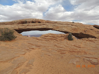
Monday, September 30, 2013

Canyonlands NP, UT - 09/30/13

Monday – September 30, 2013
The Needles
Canyonlands National Park, Utah

This was to be our last day at the Wind Whistle Campground in the Needles Outlook region of the Canyonlands National Park. However, we decided to extend our stay here by another day. It is another beautiful sunny day with the temperature in the high-70’s. Today, we explored "The Needles" region of the park, which is located 46 miles from our campground. Our route takes us six miles east on the Needles Outlook road to six miles south on US-191 to 34 miles west on the UT-211 Scenic By-Way to the park entrance.

Yesterday, while visiting the Needles Outlook we were viewing the desert floor of the canyon from up high on the rim of the canyon. Today, we are viewing the canyon from the desert floor. The numerous rock formations and vertical cliffs that loom before us, appear to reach the blue-sky above. Rock pinnacles banded in red and white are dominant in this region. Earth movements fractured the rock, and water and freezing and thawing eroded it as today’s jumbled terrain. Grassy meadows contrast with the bare rock formations and arches lend the region an unusual touch. Most of the arches lie hidden in backcountry canyons accessible only by long 4-wheel-drive-trips or hikes to see them.

We also visited the Newspaper Rock Archaeological Site. This is a petroglyph panel etched in sandstone that records approximately 2,000 years of human activity. Prehistoric peoples, probably from the Archaic, Basketmaker, Fremont and Pueblo cultures, etched on the rock from B.C. time to A.D. 1300. In historic times, Ute and Navajo people, as well as European Americans made their contributions. In Navajo, the rock is called "Tse’ Hane’" (Rock that tells a story). Newspaper Rock is listed in the National Register of Historic Places.

Tomorrow another adventure begins.

Sunday, September 29, 2013

Canyonlands NP, UT - 09/29/13

Sunday – September 29, 2013
Needles Outlook
Canyonlands National Park, Utah

The temperature dropped into the mid-30’s last night here at the Wind Whistle Campground in the Needles Outlook region of the Canyonlands National Park. Today, the temperature reached the mid-70’s and tonight the temperature will be in the mid-40’s. Such is life here in the Utah desert.

It is a beautiful sunny day, time to go exploring. We travel 16 miles west of Wind Whistle Campground to the Needles Overlook. This is the end of the road. Spread out before us, as far as the eye can see, is the canyons, mesas, cliffs and canyon floor of Canyonland National Park. This is a barren desert region, with the canyon floor perhaps a thousand feet below us. Off in the distance, we see a lush green vegetation area. Upon closer inspection, through our binoculars, we see the vegetation borders the shores of the Colorado River. As we scan the winding route of the river, we lose site of it as it cuts through deep canyons, only to reappear briefly a few miles further downstream, before we lose sight of it as it flows through another canyon.

The desert landscape below us is dotted with islands, rising towers of rock formations with deep canyons cutting through them. The islands, perhaps hundreds of feet high, rise up out of the desert floor. They all have a relatively flat surface and vary in size, with the largest being about the size of football field. The towers of rock formations, dispersed throughout the floor of the canyon, resemble clusters of skyscraper buildings.

The desert floor has a few dirt roads that offer the adventurous visitor, equipped with a four-wheel drive vehicle, hundreds of miles of exploration. On this visit, we spotted a camper-top pickup truck very slowly navigating what appeared to be a very sandy and rutted section of the road. A little later, we spotted six mountain bikers traversing this very same road, followed by what appeared to be their chase vehicle, carrying extra mountain bikes and containers of water and gasoline. To the naked eye, the vehicles and mountain bikers look like miniature figures moving along the road. Only with binoculars can they really be seen. The desert floor of the canyon is so desolate and inhospitable, that visitors must obtain a permit to travel through this region.

We spent several hours at this marvelous overlook, absorbing the majestic beauty surrounding us. We became fascinated watching a fairly large ant dragging an item, probably five times its size. It dragged the item through the rock-strewn ground for about twenty feet and then left the item on the surface of a large flat rock. It disappeared into the nearby rocky terrain. We figured it had had enough of dragging that item all by itself and had gone for help! It must have seemed to the ant that it was dragging the item through a canyon filled with boulders.

Tomorrow another adventure begins.

Saturday, September 28, 2013

Canyonlands NP, UT - 09/28/13

Saturday – September 28, 2013
Island In The Sky
Canyonlands National Park, Utah

Friday was our last day at Ken’s Lake BLM Campground, ten miles south of Moab, Utah. We have completed our very enjoyable visits to the Arches National Park and the "Island In The Sky" region in the northern area of the Canyonlands National Park. We will now visit the "The Needles" region of the Canyonlands National Park, which is in the southern area of the park near Monticello, Utah.

We departed Ken’s Lake campground at 9:15 a.m. and traveled 43 miles south on US-191 to Scenic Highway UT-211. We then traveled 34 miles west on UT-211 to the Squaw Flat Campground, arriving there at 11:00 a.m. This campground is located within "The Needles" region of the Canyonlands National Park. All campsites are First-Come-First-Serve. Unfortunately, all of the campsites were taken. So, now we must search for a BLM or National Forest campground in a close proximity to the park. Oh, did I mention there is a 10% grade for 1.5 miles westbound on UT-150! That was exciting towing the trailer down that grade.

We checked out the Needles Outpost, a private campground, located 1.5 miles from the park’s entrance station. The road throughout the campground is a red dirt road and quite rutted in places. There was only two other campers’ there, out of close to thirty campsites available. The cost per night is $20.00. We decided this was not a suitable campground for our camping preference.

We continued eastbound on UT-211 and came upon Harts Draw Road, a two-lane, paved road that went south off of UT-211. The road sign at the entrance showed this road went through the Manti-La Sal National Forest and exited at Monticello, Utah, a distance of some 18 miles. The road sign also showed a few campgrounds along this route. So, off we go on another adventure, only this time we are towing the trailer on another winding, mountain road. This road took us up some steep inclines with a few 15-mph hairpin turns. We passed the campgrounds and found them not to our liking. We finally reached Monticello and decided to refuel. We had burned almost half a tank of gas traversing those mountain roads. Gas stations are scarce in this area, no need to take any chance of running out of gas out here.

We now head northbound on US-191 out of Monticello. We travel six miles north of UT-211 and exit onto the Needles Outlook road. This is a two-lane, paved road that will take us westbound 22 miles to the Needles Overlook. After driving six miles, we come upon the Wind Whistle BLM Campground, at 1:30 p.m.

This campground has 17 campsites, vault toilets, a drinking water spigot, but no dump station. There are only five other campers here. We select campsite #1, a pull-through campsite, and set up our trailer. We are surrounded by breathtaking mountain views. What a find!

Camping Fees:
Non-Electric Sites: $15.00
Golden Age Pass holders receive a 50% discount.

There is no cellular or Internet service available at this campground through our T-Mobile service provider.

Time to relax and enjoy the views!

Total miles traveled today: 147

Tomorrow another adventure begins.

Thursday, September 26, 2013

Canyonlands NP, UT - 09/26/13

Thursday – September 26, 2013
Island In The Sky
Canyonlands National Park, Utah

Windy weather returned with a vengeance, out of the southwest Tuesday night, here at Ken’s Lake Campground, near Moab, Utah. We visited the Island In The Sky region of the Canyonlands on Wednesday and returned today to finish our tour. The temperature these past few days has been wonderful, in the high 70’s, but the wind is unbelievable, with wind gusts at almost 50 mph. Walking into these wind conditions presents a significant physical exertion. This is definitely "bad-hair-day" type of weather! Motorhomes and trailers are gently rocked as the gusts of wind sweep through the campground. It actually makes for pleasant sleeping last night.

Photography is less than ideal at the park in these windy conditions. On a clear day. views of the canyon 100 miles in the distance can be seen. Yesterday and today, the strong winds have created blowing sand storming through the canyons, creating a smog-like condition, obscuring some views of the canyons. Under these gusty wind conditions, caution is prudent when viewing the depths of the canyons from the rim.

Canyonlands is a place of colorful landscape eroded into countless canyons, mesas and buttes by the Colorado and Green rivers and their tributaries. It is Utah’s largest national park and is divided into four districts: Island in the Sky, the Maze, the Needles and the Green and Colorado rivers.

Island in the Sky
This is the highest and northernmost section of the park. Formed of a broad, level mesa, it is bordered on the west by the Green River and on the east by the Colorado River. Grand View Point Overlook provides views that encompass 100 miles of canyons. A thousand feet below is the White Rim, a nearly continuous sandstone bench that follows the contours of the mesa. Below that, the Green and Colorado rivers sedately flow toward their confluence. After they meet, they undergo a turbulent change and pass furiously through a stretch of white water known as Cataract Canyon. They then continue on their way through the Grand Canyon and out to the sea at the Gulf of California.

The Maze
This is the westernmost section of the park and is also the most rugged and difficult to access. It is one of the most remote and unreachable regions in the U.S. A 4-wheel-drive vehicle is necessary to explore this region. There are bizarre towers, walls, buttes and mesas. Prehistoric cultures have left their mark in the Maze. Ghostly, larger-than-life figures, painted more than 2,000 years ago, adorn the walls of the Great Valley in Horseshoe Canyon, a detached part of the park northwest of the Maze.

The Needles
This is in the southeastern section of the park and is an area of immense diversity, with arches, spires, canyons, prehistoric Indian ruins and fascinating pictographs.

Canyonlands remains largely untrammeled, its roads mostly unpaved, trails primitive, and rivers free-flowing. Bighorn sheep, coyotes, and other native animals roam its 527 square miles. Canyonlands is wild America.

Tomorrow another adventure begins.

Tuesday, September 24, 2013

Arches NP, UT - 09/24/13

v>

Tuesday – September 24, 2013
Arches National Park – Moab, Utah

Wonderful weather has returned, here at Ken’s Lake Campground, 10 miles south of Moab, Utah. The rainy weather has departed the area, along with the strong winds. Clear blue skies greeted us on Monday morning and again this morning, with warmer weather. The temperature is forecast to be in the mid-70’s to low 80’s for the rest of the week, along with sunny weather. This is our second day exploring Arches National Park.

We departed our campground for Arches National Park at 10:30 a.m. It is only a 15-mile drive from our campground. Our Golden Age Pass allows us to enter the park free of charge. On Monday, we stopped at the Visitor Center, watched a very nice orientation film on the park and picked up some literature. So, today we continue our journey through the park.

The park lies atop an underground salt bed that is responsible for the arches, spires, balanced rocks, sandstone fins, and eroded monoliths. Thousands of feet thick in places, this salt bed was deposited 300 million years ago when a sea flowed into the region and eventually evaporated. Over millions of years, residue from floods, winds, and the oceans that came and went blanketed the salt bed. The debris was compressed as rock, at one time possibly a mile thick.

Salt under pressure is unstable, and the salt bed lying below Arches was no match for the weight of this thick cover of rock. The salt layer shifted, buckled, liquefied, and repositioned itself, thrusting the rock layers upward as domes, and whole sections fell into the cavities.

Faults deep in the Earth made the surface even more unstable. Fault-caused vertical cracks later contributed to the development of arches. As the salt’s subsurface shifting shaped the Earth, surface erosion stripped off younger rock layers. Over time water seeped into superficial cracks, joints, and folds. Ice formed in the fissures, expanding and pressuring the rock, breaking off bits and pieces. Wind later cleaned out the loose particles, leaving a series of free-standing fins. Wind and water then attacked these fins until the cementing material in some gave way and chunks of rock tumbled out. Many of these damaged fins collapsed. Others, hard enough and balanced, survived despite missing sections. These became the famous arches. Pothole arches are formed by chemical weathering as water collects in natural depressions and then eventually cuts through to the layer below. This is the geologic story of Arches National Park.

The sheer grandeur of the Arches National Park is simply breathtaking. To comprehend how the forces of nature, over millions of years, created these variety of marvelous rock formations, defies the imagination. A paved, two-lane, winding road takes the visitor on an 18-mile journey back in time. The journey begins from the Visitor Center, at an altitude of 4,085 feet. The steep, winding, entry point road then climbs to an elevation of perhaps 5,000 feet. The remainder of the route traverses a winding road through lower and higher elevations.

Around each turn in the road the visitor is exposed to yet another scenic delight. Here are just a few highlights of nature’s wonders we observed:

Park Avenue
A magnificent view of a valley filled with light green vegetation, dark green Utah Juniper and Pinyon Pine evergreen trees, surrounded by massive bare rock formations towering above it. One of the striking features was a huge boulder, perfectly flat on the bottom, precipitously balanced upon one of the rock formations, with an equally perfectly flat surface.

Balanced Rock
This was an incredible sight! A massive rock balanced upon another rock formation.

Arches
Mother nature exhibits her finest works of art! Over 2,000 cataloged arches range in size from a three-foot opening, the minimum considered an arch, to the longest, Landscape Arch, measuring 306 feet to base.

Tomorrow another adventure begins.

Sunday, September 22, 2013

Moab, UT - 09/22/13

Sunday – September 22, 2013
Moab, Utah

We awoke to a sunny sky, warm weather in the high 60’s and very windy. Did I mention it was windy! The local weather forecast issued a wind advisory for the area, with winds gusting close to 60 mph. We had to really hold onto our trailer door really tight when we opened it or the wind would rip it right out of your hand. The weather forecast was for windy conditions with rain today and the week ahead would be dry, warm and sunny. We decided today would be a good day to scout the Moab area for areas to explore when the weather was nicer.

We stopped at the Visitor Center in Moab, on US-191, to gather information on locations for water, dump stations and BLM campgrounds throughout Utah. Of interest, almost 80 percent of Utah is public land. We continued on US-191 north of Moab to Scenic Byway UT-128. This byway skirts the southeastern edge of the Arches National Park and follows the Colorado River. Magnificent rock formations towering above this byway, dazzle one’s senses of the powerful forces at work that have created these natural works of art.

After traveling on the Scenic Byway UT-128 for about 30 miles, we turned onto the LaSal Mountain Loop Road that would take us back to our campground. What an adventure this was! It started off on a nicely paved, fairly level road. As we progressed, the road got narrower and steeper, with really deep drop-offs on one side. Naturally, that was the passenger side, so Sharon enjoyed quite a few white-knuckle moments! To make our drive more exciting, segments of the road had potholes that had to be avoided, and this was also open range for cattle! Quite a few times we encountered cattle on the side of the road and one time there were four cattle blocking the road.

We had to pass over several mountain peaks at elevations of perhaps as high as 10,000 feet, complete with foggy and rainy weather. Finally, after 65 miles, we made our descent from the last mountain peak into our campground at Ken’s Lake. We high-fived each other and promised not to explore that road again… at least not again on this trip!

Tomorrow another adventure begins.